How Your Navigation App Is Accidentally Building the Traffic Jam You're Trying to Escape
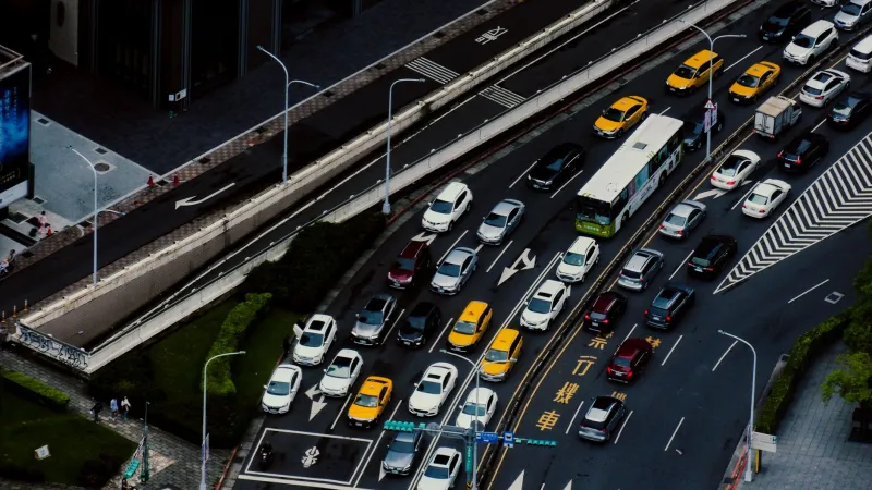
You're sitting in bumper-to-bumper traffic on the interstate when your navigation app pings you with good news: there's a faster route. Take the next exit, cut through a residential neighborhood, and you'll shave eight minutes off your commute. Sounds great, right?
Here's the thing — about four thousand other drivers just got the exact same notification.
This is the quiet irony sitting at the heart of modern navigation technology. The same algorithms designed to route you away from congestion are, in many cases, manufacturing brand new congestion somewhere else entirely. It's not a glitch. It's not a conspiracy. It's just math doing what math does when you apply it to millions of people simultaneously.
The Herding Problem Nobody Planned For
When apps like Google Maps, Waze, or Apple Maps detect a slowdown on a major corridor, they run a calculation: what's the fastest available alternative? The algorithm finds it, flags it as optimal, and pushes that recommendation to every user who's about to hit that bottleneck.
The problem is that the road they're recommending — say, a two-lane street through a quiet suburb — was optimal before thousands of cars started taking it. The moment the first wave of rerouted drivers hits that road, conditions change. But the algorithm is working with a slight lag. It takes time to collect new speed data, process it, and update recommendations. By the time the app realizes the "shortcut" is now gridlocked too, another wave of drivers has already turned onto it.
Traffic engineers have a name for this general phenomenon: induced demand. Navigation apps have added a new twist to it — induced rerouting demand — where the act of optimizing creates the very problem it's solving for.
Residential Streets Weren't Built for This
The collateral damage here isn't just frustrated commuters. Neighborhoods across the US have been dealing with dramatic spikes in cut-through traffic ever since real-time navigation became mainstream. Streets in Atlanta, Los Angeles, Chicago, and smaller cities alike have seen local roads transform into de facto expressways during peak hours.
These roads weren't engineered for that volume. They lack the lane width, signage, and traffic signal timing to handle hundreds of cars per hour. Pedestrian safety drops. Noise levels climb. Local residents — who had nothing to do with the original highway backup — suddenly can't back out of their own driveways.
Some municipalities have pushed back hard, installing turn restrictions, speed bumps, or outright blocking certain streets to through traffic. A few have gone as far as lobbying navigation companies directly, asking to be removed from routing suggestions altogether. Results have been mixed.
The Feedback Loop in Real Time
Here's what the cycle actually looks like from start to finish:
- A crash or slowdown hits a major road.
- Navigation apps detect reduced speeds and calculate alternate routes.
- Thousands of users receive the same reroute suggestion simultaneously.
- The alternate road fills up, creating new congestion.
- Apps detect the new slowdown and start routing people back to the original road — or to a third option.
- That third option gets overwhelmed.
- Repeat.
During major events or severe weather, this loop can cascade across an entire metro area. What started as one incident on one highway ends up degrading traffic flow on a dozen parallel streets within twenty minutes. The network doesn't just slow down — it locks up.
Researchers at MIT and Carnegie Mellon have both studied this dynamic, and the findings aren't reassuring. In dense urban environments, uncoordinated rerouting can actually increase total system travel time even while appearing to benefit individual users in the short term. You get there a little faster. Collectively, everyone gets there slower.
Why the Apps Haven't Fixed This Yet
To be fair, the big navigation platforms are aware of the problem. Waze, which is owned by Google, has experimented with what it calls "spread routing" — deliberately distributing rerouted drivers across multiple alternate paths rather than funneling everyone onto one optimal route. The idea is to trade a bit of individual efficiency for overall system stability.
Google Maps has also introduced features that factor in the broader traffic impact of routing decisions, not just the fastest path for the single user. Apple Maps has been quieter about its methodology, but it's reasonable to assume similar considerations are being explored.
The challenge is that these companies are competing for users, and users judge apps on their personal commute time, not on whether the regional road network is functioning well. An app that routes you two minutes slower to protect a neighborhood street isn't going to win five-star reviews. The incentive structure pushes toward individual optimization, not collective efficiency.
Predictive Routing and the Next Generation of Fixes
The more promising solutions involve getting ahead of the problem rather than reacting to it. Predictive rerouting uses historical patterns, event data, and machine learning to anticipate where bottlenecks will form before they fully develop — and to spread traffic proactively rather than scrambling after the fact.
Even more interesting is the concept of app-to-app communication, or what some researchers call "cooperative routing protocols." Instead of each navigation platform making independent decisions in a vacuum, the idea is that apps would share aggregate routing intentions — not individual user data, but anonymized flow information — to avoid all sending traffic to the same place at the same time.
This is technically feasible. The infrastructure challenge is getting competing companies to cooperate on a shared framework. That's a business problem as much as an engineering one, and it's moving slowly.
Some cities are taking a more direct approach by integrating navigation APIs with municipal traffic management systems. If the city's traffic engineers can feed real-time signal timing and road capacity data into navigation platforms, the apps can make smarter decisions that account for actual infrastructure limits — not just current GPS speeds.
What You Can Actually Do Right Now
Short of waiting for the industry to sort itself out, there are a few practical moves that can help.
First, try adjusting your departure time by even ten to fifteen minutes. The rerouting cascade tends to peak at very specific windows. Shifting slightly outside those windows can mean the difference between smooth sailing and being part of the herd.
Second, some apps let you manually lock a route rather than accepting automatic reroutes. If you know your city well enough, trusting your own read of traffic patterns sometimes beats trusting an algorithm that's simultaneously advising thousands of strangers.
Third, keep an eye on apps that incorporate city-level traffic coordination data. As more municipalities build these integrations, the platforms that support them will have a genuine edge in routing accuracy.
The navigation app on your phone is still one of the most genuinely useful tools in your daily life. But understanding its limitations — including the ways it can work against itself — makes you a smarter driver. Sometimes the fastest route is the one your app doesn't recommend, precisely because your app recommended it to everyone else first.