Two Maps, Zero Agreement: The Silent War Between Your Car's GPS and Your Smartphone
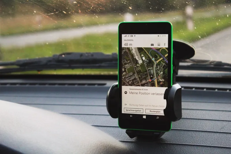
You're merging onto the highway when it happens. Your car's built-in screen confidently announces a right exit in two miles. Meanwhile, Google Maps on your phone mount is already rerouting you around a backup three exits earlier. Same destination. Same moment. Completely different instructions.
This isn't a glitch. It's a feature of a fragmented system that nobody in the auto industry really wants to talk about — and it's affecting millions of American drivers every single day.
The Two Systems Living Inside Your Car
When you buy a new vehicle with a built-in navigation system, you're essentially getting a GPS unit that was designed, mapped, and frozen in time somewhere between the vehicle's engineering phase and its showroom debut. That gap alone can be 12 to 18 months before you ever turn the key.
Your smartphone, by contrast, is pulling live data constantly. Waze crowdsources traffic incidents in real time. Apple Maps refreshes road data with satellite passes and user reports. Google Maps integrates business hours, construction alerts, and incident reports from hundreds of millions of active users.
Factory GPS systems, even premium ones in luxury vehicles, are working from a fundamentally different playbook. They're optimized for consistency and reliability in low-connectivity environments — think dead zones in rural Montana or underground parking structures in downtown Chicago. Your phone-based app is optimized for dynamic accuracy in connected environments.
Neither approach is wrong. They're just solving different problems.
Why Automakers Haven't Closed the Gap
Here's where things get interesting. Automakers have had years to close this gap, and many haven't — at least not fully. The question worth asking is whether that's a technical limitation or a business decision.
Consider this: a car manufacturer's navigation system is often tied to a paid subscription model. Ford's SYNC navigation, GM's connected services, BMW's ConnectedDrive — these all involve recurring fees or bundled service packages. Fully deferring to your iPhone's free Apple Maps or your Android's free Google Maps would undercut that revenue stream entirely.
There's also the liability angle. Automotive-grade navigation systems go through extensive certification processes. They're tested for safety, for distraction metrics, for compliance with NHTSA guidelines. Automakers are understandably cautious about handing full control to a third-party app that can update itself overnight without any automotive safety review.
But drivers aren't buying that explanation — especially younger ones.
The CarPlay and Android Auto Middle Ground
Apple CarPlay and Android Auto were supposed to solve this. And to their credit, they've helped a lot. Projecting your phone's navigation onto the car's main display gives you the best of both worlds, at least on the surface.
Except it's not quite that clean in practice.
Some manufacturers limit CarPlay to certain trim levels. Others restrict which apps can run through the system. A handful of automakers — most notably General Motors with its recent Chevy and Cadillac models — have made headlines for restricting or outright removing wireless CarPlay support in newer vehicles, pushing drivers toward their proprietary systems instead.
GM's decision to drop CarPlay from its upcoming electric vehicles sparked significant backlash in 2023, and the debate hasn't cooled down. Drivers who had come to depend on seamless iPhone integration suddenly found themselves looking at a built-in system they trusted less, navigating roads that had changed since the maps were last updated.
For a lot of people, that's not a minor inconvenience. That's a daily frustration.
The Map Data Problem Is Real
Let's set aside the business politics for a second and talk pure accuracy.
Built-in automotive GPS systems typically update their map data once or twice a year, sometimes less. In fast-growing metros like Austin, Nashville, or Phoenix — cities where new roads, subdivisions, and highway expansions are practically a weekly occurrence — that lag creates real problems.
Drivers in the outer suburbs of these cities have reported being routed down roads that technically don't exist yet on their car's map, or missing exits that opened after their last map update. It's the same phantom road problem that plagues older systems, just with a slightly newer coat of paint.
Smartphone apps, pulling from continuously updated cloud databases, don't have this problem to the same degree. Google Maps can reflect a newly opened road within days. HERE Technologies, which powers many automotive navigation systems, operates on a slower update cycle by design — stability over speed.
What Drivers Are Actually Doing
Talk to enough people and a pattern emerges. Most drivers who have both options available have developed a kind of informal hierarchy.
For long highway drives with minimal complexity, many prefer the car's built-in display — it's bigger, it's integrated with the speedometer and fuel gauge, and it doesn't drain their phone battery. For anything involving city traffic, last-minute detours, or unfamiliar neighborhoods, they default to the phone.
Some drivers run both simultaneously, glancing between them when the two systems disagree. It's not ideal. It's arguably a distraction. But when you've been burned by a bad route before, redundancy feels like common sense.
The smarter move — and one more drivers are catching onto — is understanding what each system is actually good at and using them accordingly rather than treating one as the universal truth.
Is Your Car Actively Limiting Your Phone?
This is the question that generates the most suspicion online, and it deserves a straight answer.
There's no credible evidence that automakers are engineering their systems to deliberately sabotage smartphone navigation performance. What is happening is more mundane but equally frustrating: Bluetooth and USB connections between phones and car systems introduce latency, audio conflicts, and interface limitations that can make phone-based navigation feel clunkier than it should.
When CarPlay audio cuts out mid-instruction, or when your phone's screen takes three seconds to respond through the car's touchscreen, that's usually a bandwidth or processing issue with the head unit — not a conspiracy. Older infotainment hardware simply wasn't built to handle the data throughput that modern navigation apps demand.
Still, the effect on the driver is the same: the car's system feels smoother, even if it's less accurate. That perception matters.
Navigating the Gap Until Someone Fixes It
Until the industry settles on a unified standard — and that day isn't particularly close — the practical advice is straightforward.
Keep your car's built-in map data updated if your manufacturer offers free or low-cost updates. Use CarPlay or Android Auto when you're in dynamic urban environments where real-time traffic data actually changes your route. Trust your phone for construction zones, new developments, and anywhere your car's map seems confused.
And when the two systems disagree on a highway ramp at 65 miles per hour? In most cases, your phone's live data is going to be more current. But knowing your car's system as a reliable backup — especially in areas with spotty cell coverage — isn't a bad habit to keep.
The ghost in your dashboard isn't malicious. It's just working from an older script. Knowing that changes how you drive with it.
